OsmAnd+ — Maps & GPS Offline
In-app purchases

4,6star
41,3K reviews
100K+
Downloads

PEGI 3
info


About this app
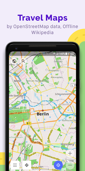
OsmAnd+ is an offline world map application based on OpenStreetMap (OSM), which allows you to navigate taking into account the preferred roads and vehicle dimensions. Plan routes based on inclines and record GPX tracks without an internet connection.
OsmAnd+ is an open source app. We do not collect user data and you decide what data the app will have access to.
Main features:
OsmAnd+ privileges (Maps+)
• Android Auto support;
• Unlimited map downloads;
• Topo data (Contour lines and Terrain);
• Nautical depths;
• Offline Wikipedia;
• Offline Wikivoyage - Travel guides;
Map view
• Choice of places to be displayed on the map: attractions, food, health and more;
• Search for places by address, name, coordinates, or category;
• Map styles for the convenience of different activities: touring view, nautical map, winter and ski, topographic, desert, off-road, and others;
• Shading relief and plug-in contour lines;
• Ability to overlay different sources of maps on top of each other;
GPS Navigation
• Plotting a route to a place without an Internet connection;
• Customizable navigation profiles for different vehicles: cars, motorcycles, bicycles, 4x4, pedestrians, boats, public transport, and more;
• Change the constructed route, taking into account the exclusion of certain roads or road surfaces;
• Customizable information widgets about the route: distance, speed, remaining travel time, distance to turn, and more;
Route Planning and Recording
• Plotting a route point by point using one or multiple navigation profiles;
• Route recording using GPX tracks;
• Manage GPX tracks: displaying your own or imported GPX tracks on the map, navigating through them;
• Visual data about the route - descents/ascents, distances;
• Ability to share GPX track in OpenStreetMap;
Creation of points with different functionality
• Favourites;
• Markers;
• Audio/video notes;
OpenStreetMap
• Making edits to OSM;
• Updating maps with a frequency of up to one hour;
Additional features
• Compass and radius ruler;
• Mapillary interface;
• Nautical depths;
• Offline Wikipedia;
• Offline Wikivoyage - Travel guides;
• Night theme;
• Large community of users around the world, documentation, and support;
Paid features:
OsmAnd Pro (subscription)
• OsmAnd Cloud (backup and restore);
• Cross-platform;
• Hourly map updates;
• Weather plugin;
• Elevation widget;
• Customise route line;
• External sensors support (ANT+, Bluetooth);
• Online Elevation profile.
Updated on
Safety starts with understanding how developers collect and share your data. Data privacy and security practices may vary based on your use, region and age. The developer provided this information and may update it over time.

No data shared with third parties
Learn more about how developers declare sharing

This app may collect these data types
Personal info, Photos and videos and 5 others

Data is encrypted in transit

You can request that data be deleted
Ratings and reviews
4,5
36,5K reviews

Peter Chapman
- Flag inappropriate
- Show review history
10 May 2021
Lots of detail and planning options that you don't get with say google maps. Love the nautical route planning. However its storage mechanism on Android... just sucks. Can't export anything because it doesn't use storage framework properly. Can't share places or tracks to any other app... the option is there but it just doesn't work. Can't cloud save either, not implemented. This has been broken for ages now.
40 people found this review helpful
OsmAnd
18 May 2021
Hello, Peter! Thank you for the feedback.
We are working on fixes for storage. Now you can try to move OsmAnd data to internal storage, it should help.

Yury
- Flag inappropriate
31 May 2023
I hoped it would be a good tool for navigation, but it doesn't work for me. Car mode has just about 5% of all the functions, you can type in something on your cars screen and voice input is not present. The app has a lot of features and modes, but it really makes it hard to find something in the settings or in the UI. No real traffic data. Sometimes map just doesn't load (though I may have to switch something on or off in the settings).
4 people found this review helpful
OsmAnd
01 June 2023
Hello! Thank you for the feedback.
Could you please provide more details about the issue?
You can contact us at support@osmand.net.

A Google user
- Flag inappropriate
29 September 2018
On F-droid market they say it tracks you, it sends phone and your apps specs to analytics server upon downloading map list... But what is worse is the basic functionality, it's very stubborn if I pick better way than the navigation it still wants me to turn back after lung time even when it means +50% higher distance. This has no clue what is optimal way. On a trip on French highway it led me thru rest stop by its ill will. Regret I paid. Each update is worse and worse, slower and sillier.
2 people found this review helpful
OsmAnd
01 October 2018
Hello, Tom! OsmAnd+ doesn't collect any personal or location data.
If you have issues with navigation, could you please contact us at support@osmand.net, and provide more info about the location where it happens?
What's new
• Discover top-ranked POIs with the new Explore mode
• All OSM routes, now searchable! Hiking, cycling, MTB, and more
• New navigation widget combines turn arrow and navigation instructions
• Current route info widget: displays ETA, arrival time, and distance
• Select ski slopes and MTB trails on the map for detailed information
• Ability to select widget size for left and right panels
• Added "Coordinates grid" with geographical coordinates
App support
About the developer
OsmAND B.V.
victor.shcherb@osmand.net
Logger 41
1186 RM Amstelveen
Netherlands
+31 6 19804549